
Tag: Embeddings
-

Satellite Embeddings in Geospatial Workflows: Navigating the Challenges and the Excitement
Using a blender (throwing diverse data into a model) has long been a popular playground among my generation of graduate students working with satellite imagery and machine learning. But as many of us have experienced, the resulting smoothie is often far from ideal. Now consider mixing data from different sensors, varying resolutions, and with different…
-
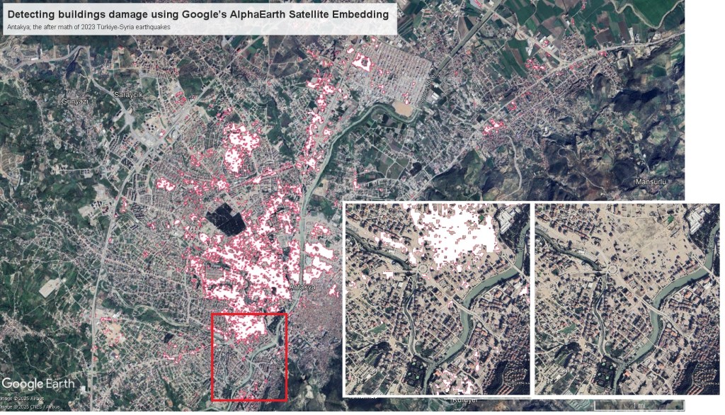
Exploring earthquake building damage with Satellite Embedding
The complexity of urban areas, with their diverse building types and structures, makes damage classification particularly challenging. Satellite images provide a broad overview of the affected areas, but their accuracy often requires validation through ground-truth data, such as field surveys. While satellite imagery can be valuable, it alone may not offer the level of precision…
-
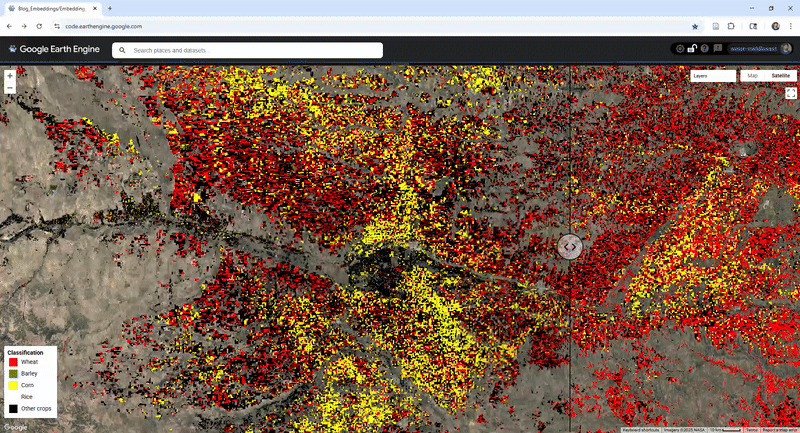
How Well Do Crop-Type Models Transfer with Embeddings? Exploring Generalization with AlphaEarth Embeddings
Remote sensing has enabled the production of up-to-date crop type maps to support food security, management, and research. However, crop types maps remain largely limited to regions where ground truth labels are available to train models. many cases, optical features do not transfer well across geographies, as models trained in one area often perform poorly…
