
Tag: disaster
-
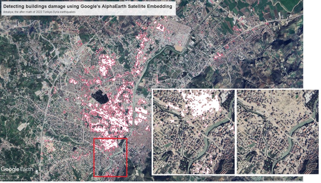
Exploring earthquake building damage with Satellite Embedding
The complexity of urban areas, with their diverse building types and structures, makes damage classification particularly challenging. Satellite images provide a broad overview of the affected areas, but their accuracy often requires validation through ground-truth data, such as field surveys. While satellite imagery can be valuable, it alone may not offer the level of precision…
